Current Weather Outlook
Statewide weather outlook from Florida Division of Emergency Management Meteorology
Monday, January 13, 2025
...Widespread Showers this Morning Throughout North Florida Associated With Gulf Frontal System Along Northeast Gulf of Mexico...Scattered to Widespread Showers Throughout North and Central Florida...Possible Rumbles of Thunder Along Coastal Big Bend and Coastal West-Central Florida; Overall Activity Very Limited...No Organized Risk for Flash Flooding; Nuisance Flooding and Ponding of Water Possible With Heavy Downpours...Extensive Cloud Cover and Showers to Keep Temperatures Below Normal Across Normal...Shower Activity to Become More Isoalted to Scattered Overnight South of I-4 Corridor...Cooler and Drier Conditions Return Across North Florida Overnight...Low Temperatures to Return to the 30s With Portions of Northern Panhandle Falling Near or Below Freezing...Patchy Frost Possible Throughout North Florida Early Tuesday Morning...Feels-Like Temperatures, or Wind Chill Values, Falling Below Freezing North and Along I-10 Corridor; 30s for Rest of North Florida...High Risk for Rip Currents Across Panhandle Beaches; Moderate Risk for Central Florida Beaches...
Updated at 9:45 AM EST
Today's Threats:
|
No Threat |
Low Threat |
Medium Threat |
High Threat |
|
Lightning |
Tornado |
Damaging Wind/Hail |
Flash Flooding |
Wildfire |
Freezing (Overnight) |
Coastal Flooding |
Rip Currents |
|
Iso. Coastal Big Bend & Coastal West-Central FL |
|
|
Locally Iso. North & Central FL |
N. Panhandle Iso. Panhandle & W. Big Bend |
Panhandle Central Florida Northeast FL |
![]()
Weather Summary for the Next 24 Hours:
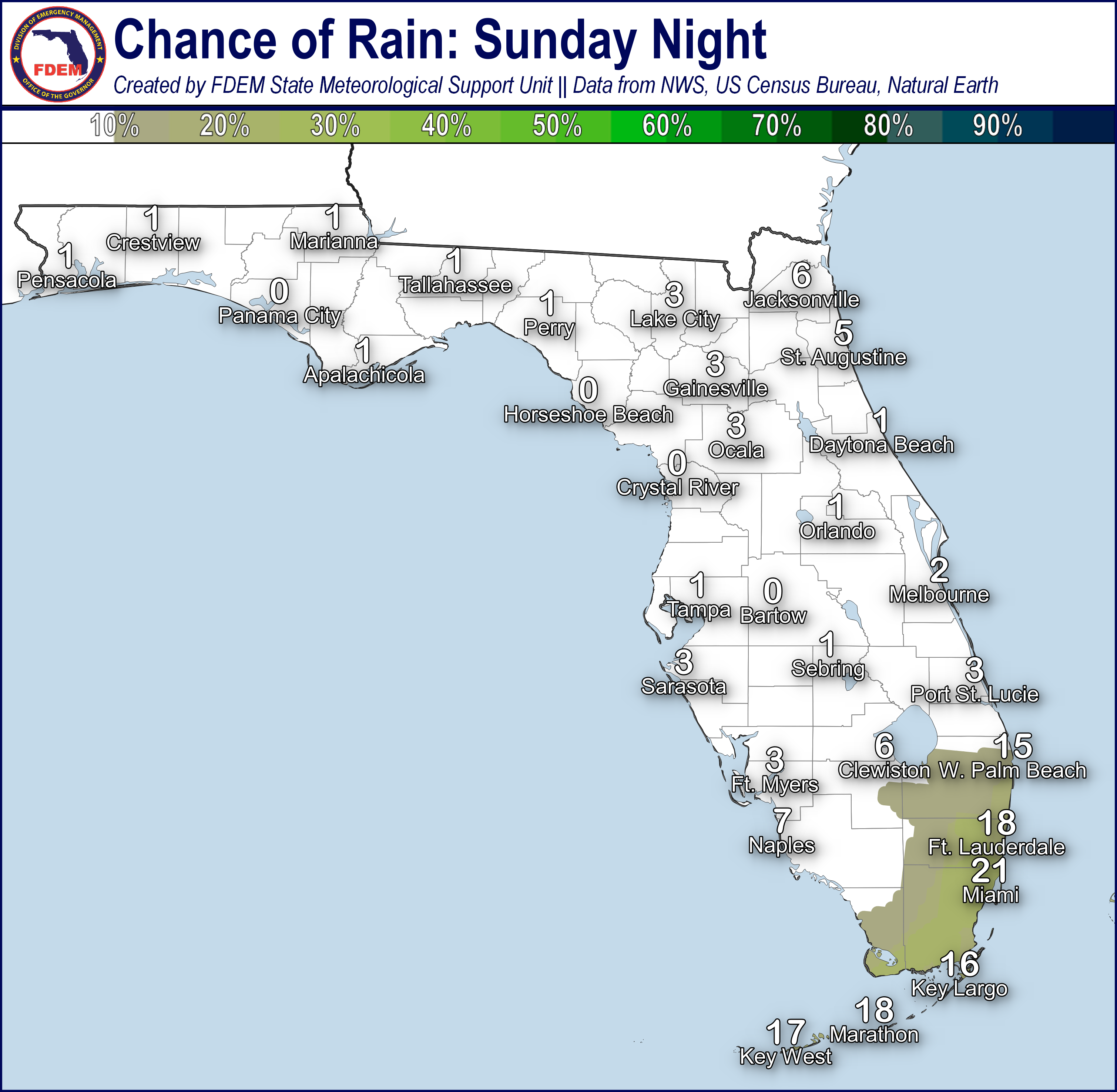
A more active weather pattern can be expected today as an area of low pressure and its attending cold front moves eastward along the Gulf Coast today into the weekend. Winds ahead of our next weather system will turn out of the southeast and south, bringing moisture and warmer temperatures back to the Sunshine State. Afternoon high temperatures will reach the lower to middle 60s across North Florida and the lower to middle 70s through the Florida Peninsula. Southerly breezes become moderate to strong along the Florida Panhandle today, with sustained winds of 15-25 mph forecast; Wind Advisories will be in effect along the Emerald and Forgotten Coasts until 1:00 AM EST/12:00 AM CST (1/11) for frequent wind gusts of 30-40 mph expected. Rain chances will increase from west to east along the I-10 corridor, with the highest chance of rain residing along and west of the US-231 corridor during the daytime hours (75-near 100%). Thunderstorm activity is not anticipated with this activity; however, localized instances of ponding water cannot be ruled out over the low-lying and flood-prone locations in the western Florida Panhandle.
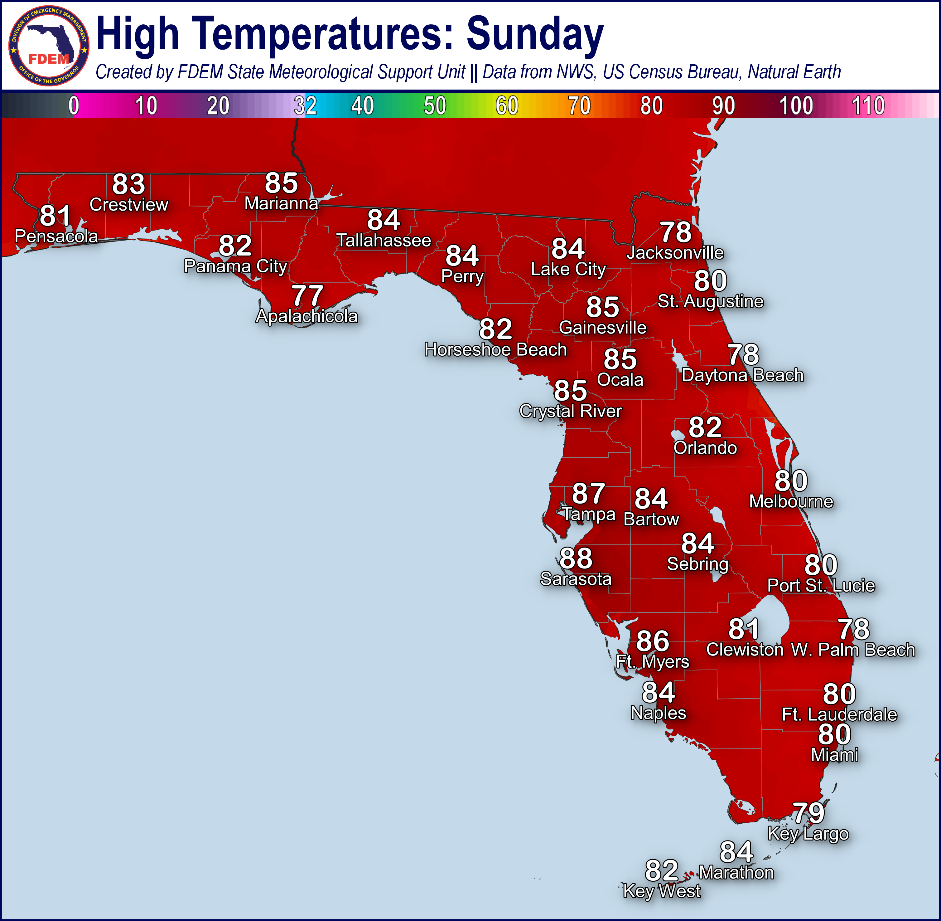
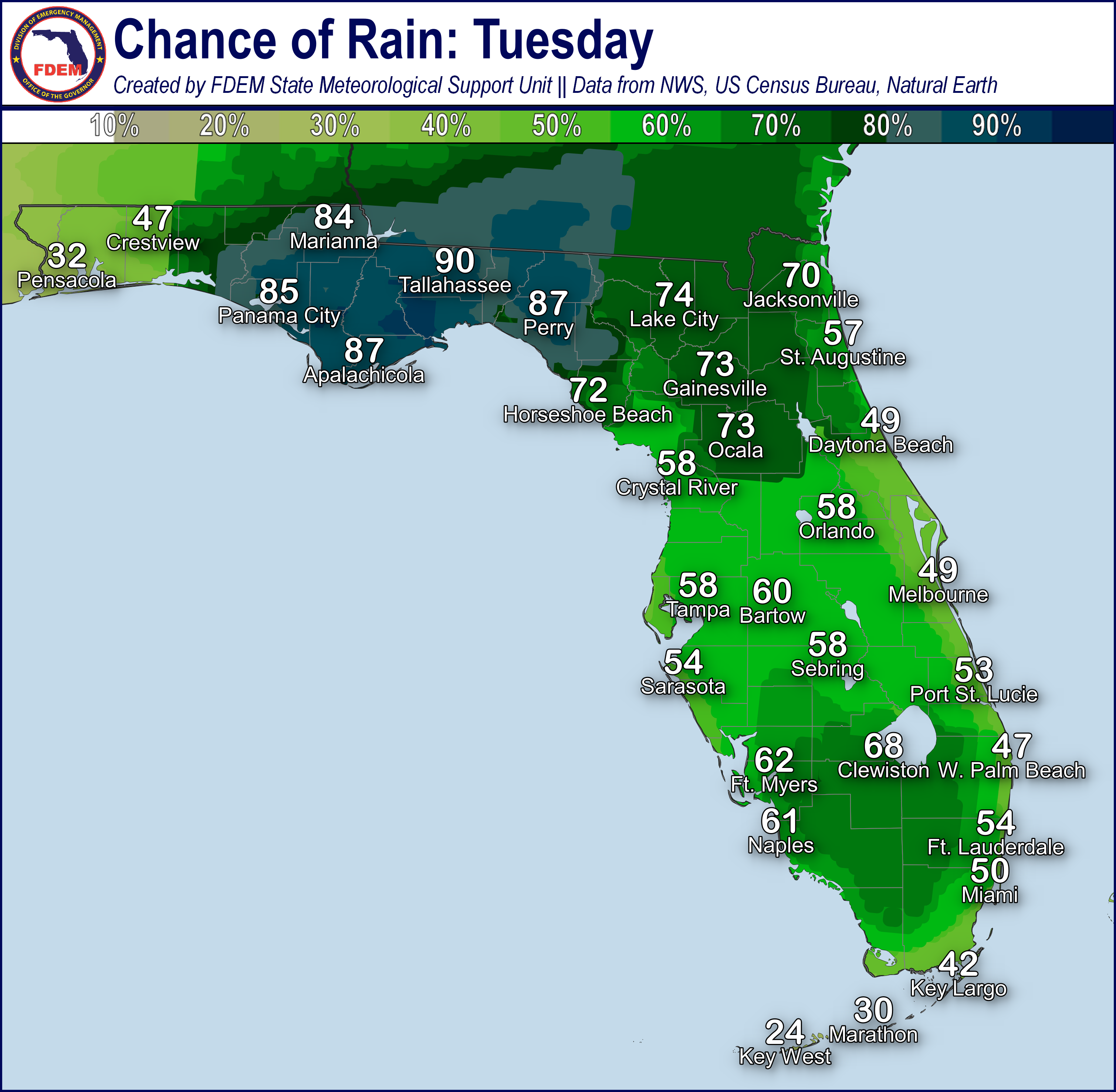
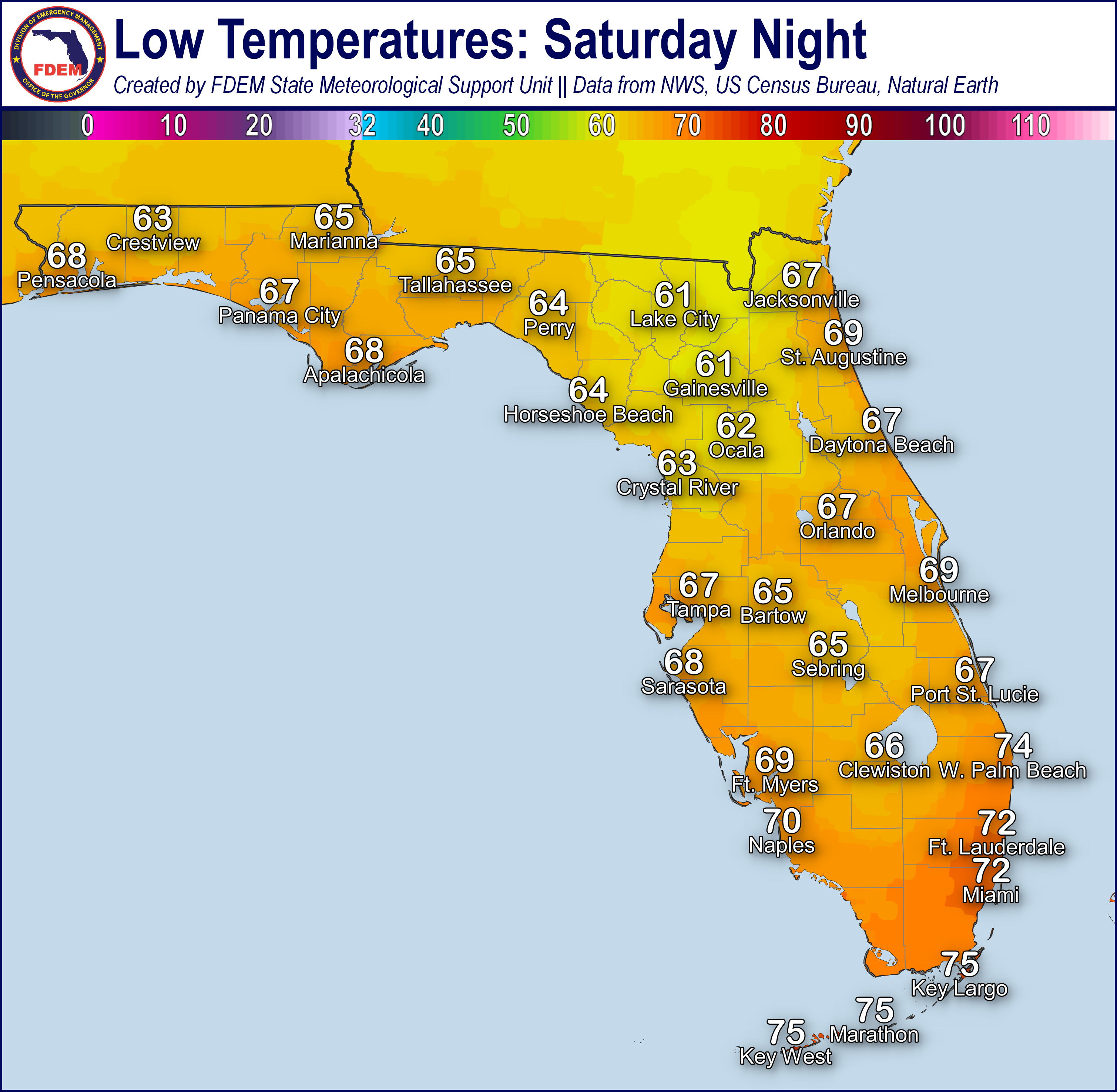
Rain chances will expand eastward tonight into Saturday morning as the cold front propagates toward the Florida Peninsula, with the greatest rain chances spreading from the Florida Panhandle to the Florida Big Bend and Northeast Florida (80-near100%). The presence of abundant cloud cover and rain will keep overnight temperatures more mild than recent days, with lows in the 40s and 50s across North Florida, the 50s and 60s throughout Central Florida, and even the middle 60s to lower 70s through South Florida and the Keys. Behind the cold front, temperatures may fall into the middle to upper 30s over interior Northwest Florida; however, widespread freezing temperatures will hold off until Saturday night.
![]()
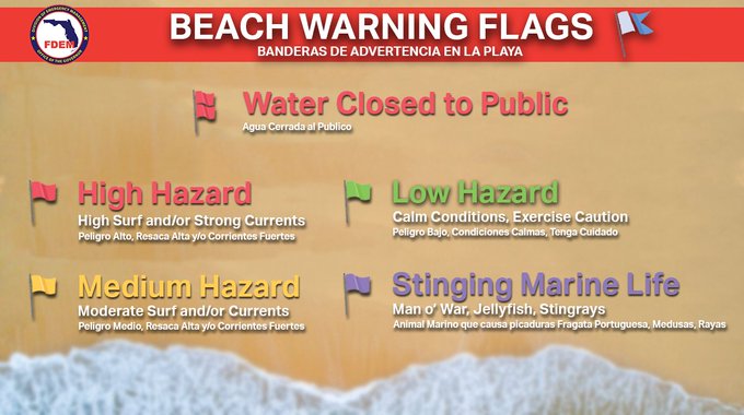
Rip Currents: A high risk of rip currents can be expected along all Florida Panhandle and Southeast Florida beaches today, with a moderate risk extending along the Atlantic Coast. Low risk conditions briefly return to the West Florida Coast. For the latest Rip Current Outlook, visit www.weather.gov/beach.
Marine Hazards: Dangerous beach and marine conditions can be expected along the Florida Panhandle today, with High Surf Warnings and Advisories in effect this afternoon into Saturday morning. Wave heights of 5-8’ can be expected along many Florida Panhandle beaches, with breakers reaching 8-10’ along the Emerald Coast. Wave heights of 3-5’ continue along the Florida East Coast.
Red Tide has been observed in 60 samples collected from Florida’s Gulf Coast (valid 1/8/2025). Background to low concentrations have been observed in Pinellas County and Lee County, with very low concentrations sampled offshore of Levy County. Background to medium concentrations was observed in Manatee County and Collier County, with up to high concentrations now observed Sarasota and Charlotte Counties. Fish kills suspected to be related to Red Tide were reports along Sarasota, Charlotte, Lee, and Collier Counties. Instances of respiratory irritation were reported in Sarasota, Charlotte, Lee, and Collier Counties.
Coastal Flooding: Strong southerly winds will bring minor coastal flooding to Apalachee Bay this evening and tonight; Coastal Flood Advisories have been raised for coastal Wakulla and Jefferson Counties where water levels of 1.5 to 3’ above normally dry ground can be expected, with additional extensions eastward along the coastal Florida Big Bend possible.
![]()
Fire Weather: Widespread moisture and rainfall across North and Central Florida will keep overall wildfire conditions low. Scattered to widespread showers will move across North and Central Florida today, with more scattered showers possible throughout South Florida overnight. Breezy wind gusts of 10-15 mph will be possible throughout the day across North and West-Central Florida, with possible wind gusts upwards of 20 mph along the western Panhandle at times. Cooler and drier conditions will move in this evening and overnight throughout North Florida. Areas of frost will be possible along the I-10 corridor early Tuesday morning. According to the Florida Forest Service, there are 30 active wildfires across the state burning approximately 239 acres.
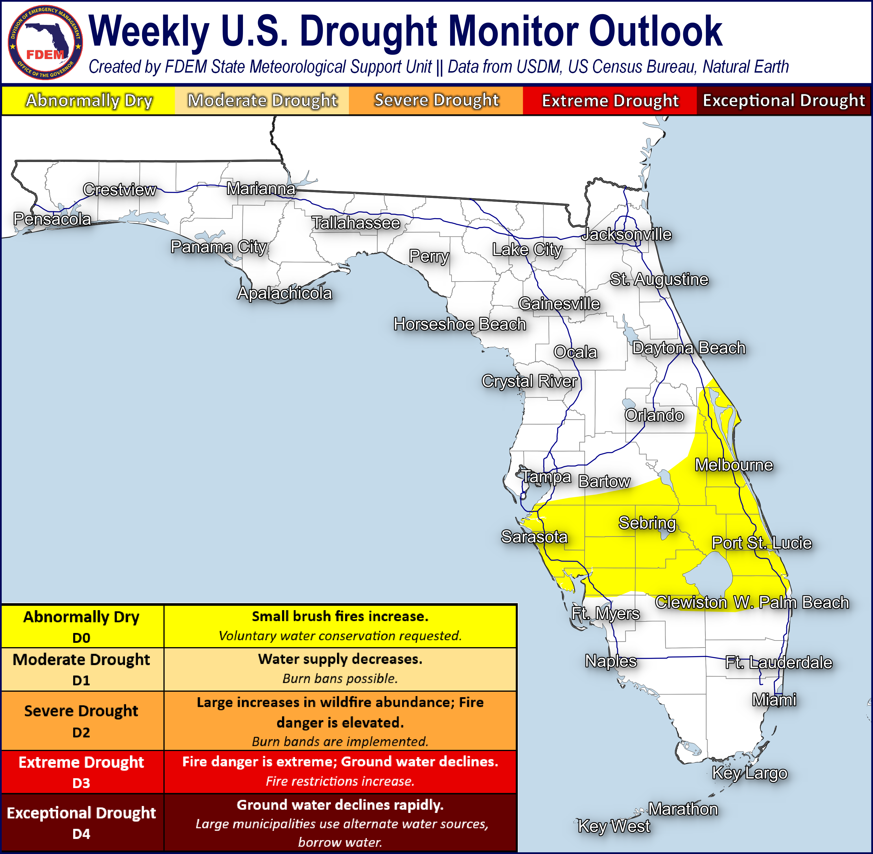
Drought: Little to no changes were made to Thursday's update to the Monitor (1/9), with nearly the entire state under Abnormally Dry (emerging drought) and moderate drought conditions. Widespread Abnormally Dry (emerging drought) conditions continue across the Sunshine State, with moderate drought over the Apalachicola River Basin in the central Florida Panhandle as well as across the Florida Big Bend and Northeast Florida. Rainfall departures over the past 60 days continue to run below normal, with widespread deficits of 2-3” observed from the central Florida Panhandle through the Peninsula. Long-term rainfall totals are running 3-5” below normal across localized areas in the eastern Florida Panhandle, inland Big bend, and along the Southeast Florida I-95 corridor.
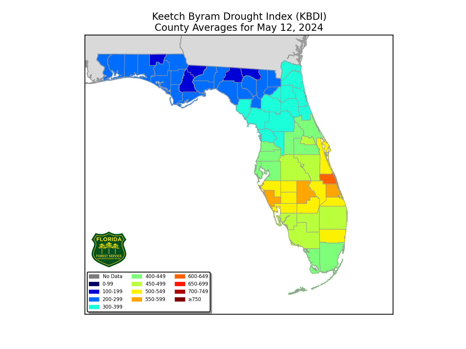
The Keetch-Byram Drought Index average for Florida is 348 (+1) on a scale from 0 (very wet) to 800 (very dry). There are 7 Florida counties (Broward, Charlotte, DeSoto, Glades, Manatee, Palm Beach and Sarasota) with an average KBDI over 500 (drought/increased fire danger).
![]()
Flash Flooding: Isolated instances of ponding water and flooding cannot be ruled out over the far western Florida Panhandle today into tonight as an area of low pressure advances eastward along the Gulf Coast. Rainfall totals of 0.5-1” can be expected across the Florida Panhandle, mainly west of the Apalachicola River, with locally higher amounts of 1-2” possible closer to the Alabama state-line. The Weather Prediction Center (WPC) is outlooking a Marginal Risk for Flash Flooding (level 1 of 4) along and west of US-331; however, dry antecedent conditions will work to limit the extent of flooding.
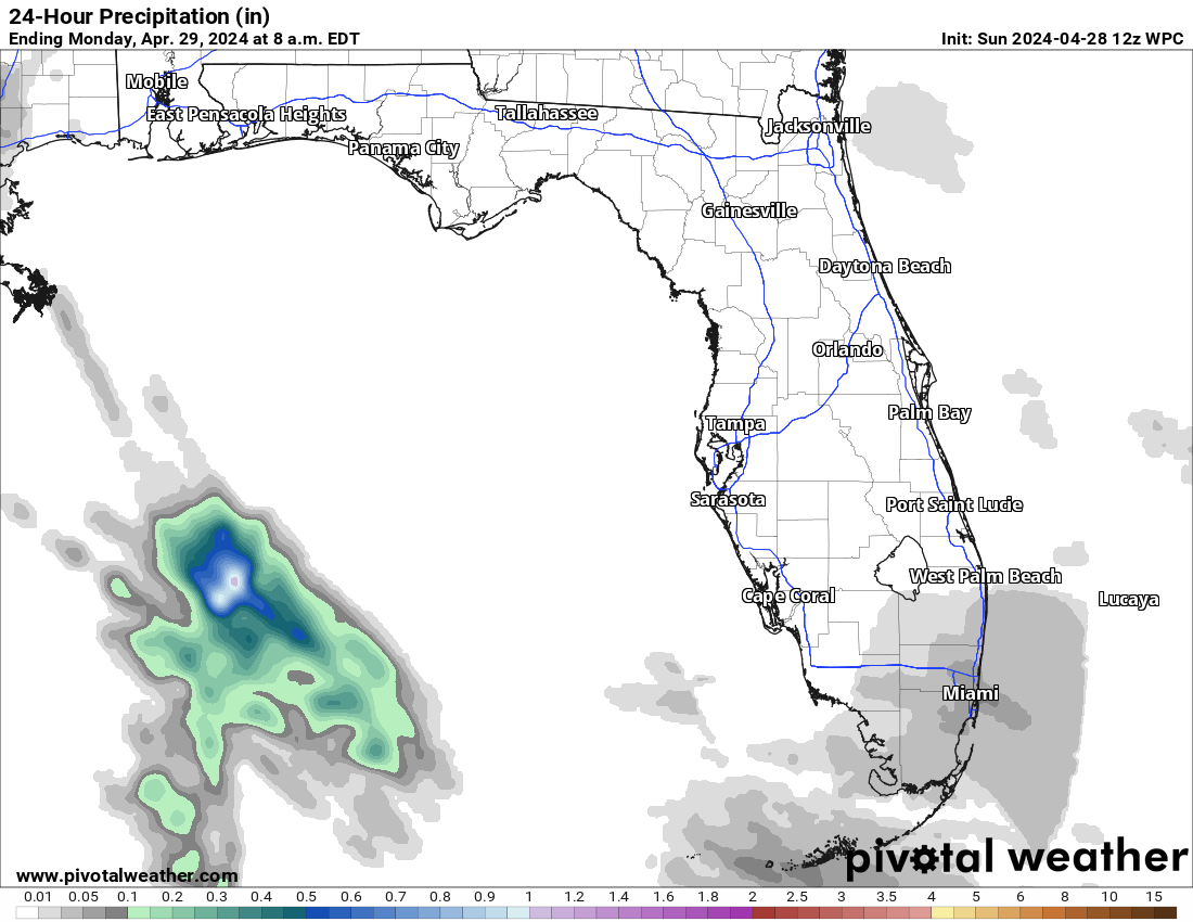
Riverine Flooding: Riverine flooding is not forecast across Florida today. Instances of heavy rainfall may lead to water level rises along the quicker-response rivers in the western Florida Panhandle. Portions of the Shoal River (near Crestview) is forecast to reach Action Stage (bank-full) later this weekend; however, which basin sees the greater riverine response will be closely tied to the location of the heavier rainfall totals. For more information, visit the River Forecast Center.
Lake Okeechobee’s average elevation is 14.83 feet, which is within the operational band and is 0.09 feet above than normal for this time of year.

